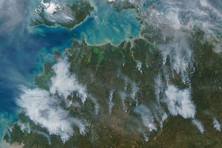
NASA satellites have been closely observing wildland fires in Australia’s Northern Territory, particularly in the Top End and Arnhem Land regions, during May and June. While some blazes, as seen by the Aqua satellite on May 28, 2026, can appear as large wildfires with extensive smoke plumes, many often seem smaller and less imposing.
This pattern, with fires appearing more intense in the afternoon than in the morning, is consistent with prescribed burns. Land managers typically initiate these fires in the morning to manage the landscape. The resulting smoke can build throughout the day, sometimes creating significant plumes when combined with updrafts and moderate winds, as observed on May 28 and June 2. These controlled fires are designed to burn through the fire-adapted vegetation of the region’s tropical savanna ecosystems.
For decades, land managers in the region have blended traditional Indigenous knowledge with modern technology for large-scale landscape management. Initiatives like the West Arnhem Land Fire Abatement and Arnhem Land Fire Abatement projects aim to strategically burn underbrush early in the dry season (May-September). This creates firebreaks and reduces fuel loads, thereby mitigating the risk of more destructive and emissions-heavy fires later in the season.
Evidence from satellite observations suggests these prescribed burning efforts are effective. Research indicates a shift in fire activity from the late dry season to the early dry season, resulting in a reduction of high-intensity fires and associated emissions.